


Les Lacs de Pétarel et de Sebeyras

bourel.jacques
User

Length
17.4 km

Max alt
2464 m

Uphill gradient
1417 m
Km-Effort
36 km

Min alt
1093 m

Downhill gradient
1417 m
Boucle
Yes
Creation date :
2015-08-02 00:00:00.0
Updated on :
2015-08-02 00:00:00.0
7h21
Difficulty : Very difficult

FREE GPS app for hiking
 SityTrail
IGN / Geographical institutes
SityTrail Plus
The world is yours!
About
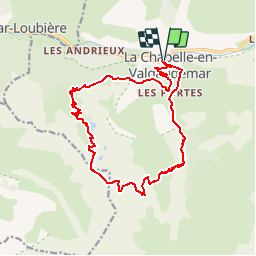
Trail Walking of 17.4 km to be discovered at Provence-Alpes-Côte d'Azur, Hautes-Alpes, La Chapelle-en-Valgaudémar. This trail is proposed by bourel.jacques.
Positioning
Country:
France
Region :
Provence-Alpes-Côte d'Azur
Department/Province :
Hautes-Alpes
Municipality :
La Chapelle-en-Valgaudémar
Location:
Unknown
Start:(Dec)
Start:(UTM)
278121 ; 4966539 (32T) N.
Comments